Gabe's R2R2R Adventure

Backstory
I've pined to do the Grand Canyon Rim-to-Rim-to-Rim (R2R2R) since I first heard about it sometime in 2015. The challenge was finding someone else crazy enough to do it with me. I could never make schedules line up with the handful of BAMFs like @tim cronk to do it. A few days after Wasatch 100, I was already jonesing for one last adventure for the season. I floated the idea with my buddy Justin. He paced me at Wasatch this year, and I paced him last year. He's a badass athlete, so I knew he could handle it. Much to my excitement, he said yes right away! We'd just have to take our shot in November after his son's football season ended.
November is a dicey time to do R2R2R because North Rim is shutdown. The road is closed after the first big snow, usually sometime in late November. I diligently watched the forecast, relieved that there was no sign of snow.
The Plan
The plan was to start from North Rim, since that is easier to access from Utah. A buddy who had done R2R2R over two days told me about the Jacobs Lake Inn, a hotel about 45 miles outside North Rim. We'd launch from there early in the morning. It would also be great to have a shower after a long day versus camping at North Rim, which was completely shutdown.
Some of you have probably detected that I am a planner. I researched the adventure by reading countless blogs and discussions on the Facebook R2R2R group. Most athletes take the approach from South Rim. Based on the research, I created the below plan. I estimated it would take about 12:20 hours running time with another 2-3:00 hours for breaks and soaking in the scenery, for a total time around 14-15:00 hours. We ended up damn close to that plan.
Giddy Up!
We drove down Friday, timing it so we could get out to North Rim before sunset. It was completely deserted, with the North Rim Lodge boarded up. We walked out to Bright Angel Point to get a bird's eye view of the route. It was exciting and intimidating at the same time to see the distance we had to cover.

The view from Bright Angel Point looking toward South Rim at sunset.
We headed back to Jacob's Lake Inn. The place was shrouded in smoke because the Forrest Service was doing a controlled burn. There were no other options for lodging in the area, so we had to just suck it up.
R2R2R In Pictures
The best way to tell the story is with pictures. They still don't capture the majesty but do a better job than words.
I was up at 2:00AM because I was struggling to sleep with all the smoke in the air. Justin woke up and I said, "why don't we just start early?" Next thing I knew it was 3:30AM and we were in the parking lot at the North Kaibab trailhead. My car said it was 18F outside, so we got ready inside my car. Then we jumped out and snapped a quick pic before we started running to stay warm.
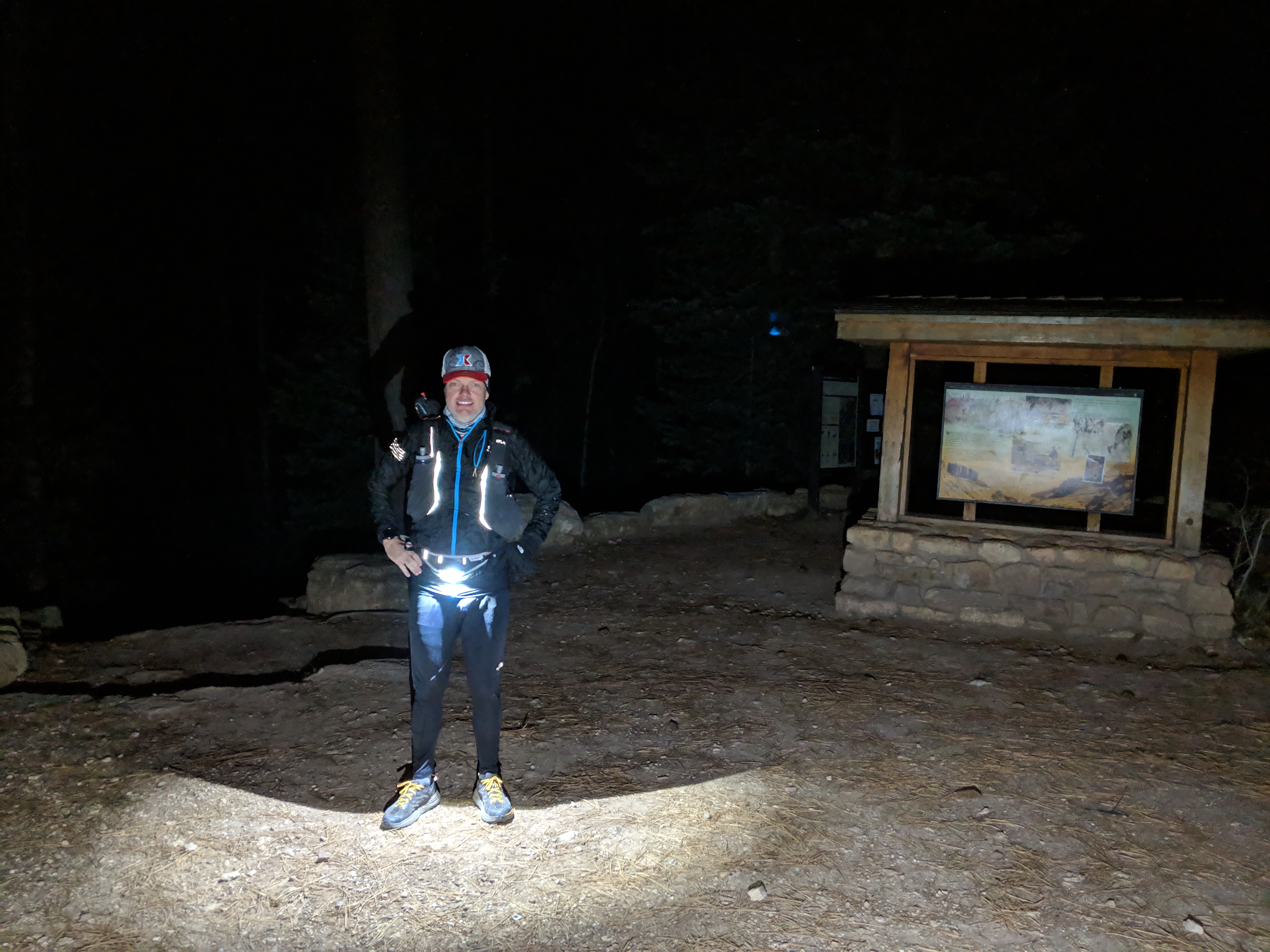
The start at North Kaibab where it was 18F.
We ran in the darkness for about 3:00 hours. Going down North Kaibab seemed pretty easy. I knew there were some exposed sections but I could just see an inky black abyss. On the way back I saw that a bad trip could have meant plunging over 1,000ft to certain death. Glad I ran down in the dark. BTW, my Lumen 600 waist lamp was so money.

Our first glimpse of light somewhere in the Box.
We went through Phantom Ranch at about mile 15 just as the sun rose. The place was quiet. We refilled our water and headed to the Colorado River where we crossed the Silver Bridge.

Standing on the suspension bridge over the Colorado River.

Selfie on the suspension bridge.

Sunrise over the Colorado River.
After the bridge, we started up the Bright Angel Trail to South Rim. After climbing the Devil's Corkscrew, we got our first view of the intimidating climb up to South Rim.

Climbing the Devil's Corkscrew.

Looking up at South Rim. Holy shit, we have to climb that!
It was a grind up Bright Angel Trail. I put on my Aftershokz headphones and cranked up the Hamilton soundtrack -- "I am not throwing away my shot!" We went up at a good clip. We were faster than riders on horses, and they had to pull aside to let us pass. Finally we spilled out in Grand Canyon Village to tourists asking how far we'd gone down. When we told them we started at North Rim and were going back, they looked at us like we were insane. They were probably right.

One R2R down, one more to go! About 25 miles in with 5,000ft of vertical. We just have to do that again.
We went to the Bright Angel Lodge nearby to grab breakfast, ordering breakfast sandwiches to go. We sat overlooking Grand Canyon and scarfed down the best breakfast sandwiches ever. We called our families. I did a video chat with my girls. I showed them the Grand Canyon, but they were more interested in what I was eating. That's my girls!
It was mentally challenging to ponder going back across. We refilled our water bottles and then started slowly. I was stiff after our 30 minute or so break. I pumped up Hamilton again -- "sit down, John, you fat motherf**ker!" I was feeling great as the food and Coke kicked in. We flew down Bright Angel. The other hikers either cheered for us or asked what the F we're doing.

Cruising back down Bright Angel Trail.
We were back at Phantom Ranch in a blur. It was hot, about 70F. We took off a layer, running in shorts and tee shirts. It felt great. We stopped at the Phantom Ranch cantina for some of their world famous lemonade. It lived up to its reputation. We ran into another group of runners from Utah also doing R2R2R from North Rim. They must have gone up South Kaibab Trail because we didn't see them earlier.
We headed out toward the Box. From here on out the trail would be "new" since we'd run through it in the dark. The Box is a narrow canyon with Bright Angel Creek running down it. Since it was unexpectedly hot, we started our heat protocol taking a salt tab every hour or so we were in the Sun.

The Box.

One of the many bridges we crossed in the Box.

The same spot where we saw our first light of the day in the Box.
The section through the Box is a gradual climb. We'd alternate between walking and hiking. My Fenix 5 was struggling to keep a lock in the canyon, inaccurately reporting that we'd busted out a 5:00/mile. We emerged from the Box out of water. A stream cut across the trail, so we produced our Katadyne water filter flasks and gulped down a bunch of water. The heat was starting to get to us.
We made it to the Manzanita rest stop, which meant we had about 44 miles down and 5.6 miles to go. But we still had to climb about 4,000ft. Justin had carried a bottle of Coke for just this moment. I drank some with a Snickers bar. We came around the corner and couldn't believe what we'd missed in the dark.

Roaring Springs just erupts from the side of a mountain. We heard this in the darkness the first time through. This supplies the water for Grand Canyon Village.

Before sunset heading up North Rim. One of the best sights of the day.
Light faded to darkness about 3 miles from the end. Somewhere in there my Garmin rebooted and closed the file. I started a new one. We fired up our Lumen 600 lamps again.
It was head down and grind time. More Hamilton got me up the North Rim -- "what is a legacy?" Time seemed to stop as we marched up. Eventually we saw the silhouetted trees of the North Rim and knew we were close.
Just like that we were back in the parking lot at North Kaibab trailhead. It took us about 15:00 hours with about 12:30 hours moving time. Almost exactly as I planned.
What a great day, one of the best ever!
Comments
Wow! Great report. Brings back so many memories!
@Gabe Peterson what was your gear setup? It sounds like you did this basically unsupported so what all did you carry to make it happen? I would love to do this sometime and am curious if the logistics
Congrats on just another epic feather in your cap!
@John Withrow thanks, man! I read your report several times to get ready. It was a huge help!
@Scott Giljum I really liked how little gear you have to bring for R2R2R. I carried more for most of my training runs for Wasatch 100. In particular, you don't have to pack a bunch of water because there are so many refill opportunities along the way. About half the water sources were off to prevent pipes from bursting in the freezing temps, so it would be even better during the fall or spring. You also get at least one opportunity to buy food.
The biggest variable I had to prepare for was the wide range of temperatures. It started at 18F and hit a high of 70F in the Canyon. For clothes, I started with layers: shorts, running pants, tee shirt, pullover, ultralite jacket, gloves, skull cap, buff, and EN trucker hat. As it got warmer, I stowed the gloves, skullcap, ultralite jacket, buff, and running pants in my Salomon running vest. When it got hot, I tied my pullover around my waist. I ended up putting the pullover back on for the climb up North Rim.
For hydration, I had two 0.5L soft flasks for 1L total. I carried packets of Tailwind powder and mixed it up along the way until I ran out. Then I just did water. I had a Katadyne BeFree water filter flask. I love that thing -- it stows easily when not in use. Or you can use it for 1L extra water storage. The trail runs along Bright Angel Creek for about 10 miles (or 20 miles total) between Manzanita and Phantom Ranch. So there are plenty of opportunities to filter water. I only filtered once.
For nutrition, my plan was to have about 2000 calories. I had about 1000 in Tailwind and then another 1000 in a PB&J sandwich, bars, and leftover Halloween candy. I knew for sure I'd be able to get more food at Grand Canyon Village and possibly Phantom Ranch (the Cantina hours can be flaky). But worse case I could survive off 2000 calories. I ended up taking down at least 1000 calories at Grand Canyon Village in the form of a breakfast sandwich and large Coke. Then I had a large lemonade at Phantom Ranch. I ended with food leftover.
Other helpful gear...
The one caveat I would add is if you are going South to North to South in the offseason (Oct 15 to May 15). North Rim is completely shutdown. You should have either someone meeting you at North Rim or enough gear to camp overnight. We ran into a solo runner going the opposite direction also doing R2R2R. We never saw him coming back and wondered what happened. Well, the next morning while eating breakfast at the Jacob Lake Inn he sat down next to us. He was done when he got to North Rim and couldn't go on. He was going to have to sleep in a port-a-potty as the temperature was in the 20s until he could call a friend to get him. He got lucky and an older guy was dropping off his wife for some hike to the South Rim. The older guy had an extra sleeping bag and let the errant runner camp with him.
Awesome report Gabe, inspiring as always. Congrats 👍️
Great report and perspective from the North to South to North view. My only question is what do you think about 1 more lap for the double?
@KARL BONNER thanks, it was a blast!
@tim cronk I can see why most do R2R2R from the South -- that climb up North Rim to finish is a bitch!
Justin (my buddy who did R2R2R with me and who has done a bunch or ultras and IMs) actually discussed doing the double R2R2R while we were out there. We agreed that you'd need to have 100-miler fitness. I was able to coast in off my Wasatch 100 fitness from two months ago and do enough to preserve fitness so it wasn't a super painful day. We thought the double would be a nice cherry on top of a mountainous 100, maybe six weeks after the event. My sense is the Bear 100 and Wasatch 100 are harder than doing a double. Do a similar 100 and then ride the fitness into a double R2R2R! I'd probably do it from the South so I could have a room at Bright Angel Lodge to shower, change, eat, and nap between R2R2Rs. One of these days...
Fantastic Gabe - thanks for taking such great photos along the way. And hey - planning is a sport - looks like it paid off! Congrats!
@Gabe Peterson what a nice way to end the season !
You mostly already answered my questions I had, but that trail is definitely on my bucket list. That place looks so beautiful and challenging.
In any case, do you think its possible to do it solo or its best to be with someone ?
@Gabe Peterson great report. Very informative and inspiring. once again the most awesome pictures.
@Gabe Peterson
I'm like your girls ... I want to know what you ate! It seems like staying hydrated would be a challenge. The filter flask sounds handy on any trail.
Photo journalism! Awesome report smiley.
Thanks, @Jenn Edwards, @Robert Sabo, and @Sheila Leard!
@Francis Picard it's definitely doable solo. There is a lot of traffic on the trail, even in the offseason. Help would not be far away. But I think it was much more fun having someone to share it with. Besides, you won't have to do it solo, I'll do it with you!
Congratulations @Gabe Peterson! Ioved the report and pictures. You make it sound so easy but those climbs are tough! Just once up and diown is hard enough. Thanks for sharing and leading!
Congrats! I've never seen it live and in person other than from the air. Loved the photos! Can't imagine all that climbing!
What is the milage and elevation climbed in The R2R2R?
Great report Gabe. Looks like the planning and the fitness payed off.
@Tim Sullivan thanks, all the vertical this year (over 178k ft!) getting ready for Wasatch paid off! Those climbs would have been killers otherwise.
@Trish Marshall thanks, you should definitely check it out! It's one of the natural wonders of the world for good reason.
@Robert Sabo My GPS was bouncing all over the place in the Canyon, so I didn't get a very accurate measure of the distance. The route I took of North Kaibab to Bright Angel and back is reported at 48 miles. I'd say it's closer to 50 miles. It has just over 10,000ft of vertical, which all comes in the two big climbs up South Rim and North Rim.
Here is the Relive video of the adventure. Like I said my GPS was wonky but this give you a good I of the route.
@Mark Maurer thanks, it is definitely very cool to be able to do this kind of crazy shit with my 45th birthday coming up next week!
Hey @Gabe Peterson second time I am reading this and love it twice as much the second time.
I want to hijack of this thread and ask a question. :)
I will be back in the US for 2+ weeks in April/May 2019 and I am interested in doing R2R, camping the night, and then going back the next day R2R. Is it possible to camp on one end? If not any suggestions?
And which route do you all suggest based on time of year. My 100K A race is in June so I am using this an epic training weekend. So I am up for the harder option if there is one.
Thanks in advance.
@Patrick Large it's definitely doable. Weather-wise, that would be an ideal time of year. North Rim doesn't open until May 15, so it will be pretty deserted. I think the road should be open, however.
Here's are two options that occur to me:
Let me know what you decide, perhaps I'll join you!
Thanks @Gabe Peterson
Looks like our dates are April 19 - May 4th, so the North Rim is out if not open. I also looked at the Bright Angel around those dates and it seems all booked up. With that said Airbnb has a lot of places that are pretty bare bones. All I really need is a hot shower and a place to rest my head at night.
I'l let you know our plans as we get closer and of course you are more than welcome to join if it fits into your schedule :)
@Gabe Peterson
Looks like the dates are set (kind of) for my R2R, camp the night, R2R.
I have free from April 22nd - April 25th. The 22nd is Easter Monday.
I am checking with a buddy of mine who has committed to run with me, but I think it will look like this: Run Monday the 22nd, Stay the night, Run back on Tuesday the 23rd, spend the night, and then home on the 24th.
It seems like all the cool spots (i.e. Bright Angel) are booked up, but there seem to be a lot of Campers/Stationary RV's that are available through Airbnb.
@Patrick Large sounds like a great adventure! I like the idea of breaking up the crossing over two days. It will give you more time to enjoy the Canyon. There is a shuttle system in the Park, so you might find a room at one of the hotels that's not right at the Rim, such as the Yavapai Lodge. I stayed there with my family in October, and it's not bad.
You should join the R2R2R Facebook group, if you haven't already. It's a great source of info. The one wild card I could see is that the North Rim doesn't officially open until May. I'm not sure if the road is typically open in April. It would be worth posting on the Facebook group to find out.
@Gabe Peterson thanks for the reply. I just joined the facebook group so I will be poking around there as well. The info on the shuttle system and the other lodge is sweet, thanks.
One of these days I think that I will do R2R2R in one go, but for me this will be a glorified training day for my main race in June, so back to back R2R's does the job.
Gabe, let's assume the that north rim doesn't open until May and the road is closed. Does that mean that we need to go south to north, camp, then back north to south? Or does it mean that we are S.O.L because if the north rim is closed there will be nowhere to camp?